
France Just Got Its First Fire-Breathing Dragon of Clouds
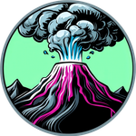
A wildfire in southwestern France recently built its own thunderstorm on top of itself and used it to get worse. This is an atmospheric event that can happen.
Officials confirmed the formation of what is thought to be France's first-ever pyrocumulonimbus clouds, a phenomenon so cinematic that scientists sometimes just call it a fire-breathing dragon of clouds. They form when intense wildfire heat drives smoke, ash and water vapor high into the atmosphere; as the rising plume cools, the water vapor condenses around tiny ash and smoke particles, creating a towering cloud that can climb more than 30,000 to 50,000 feet into the sky, sometimes reaching the lower stratosphere.
Here's where it turns ugly. These clouds don't just hover. They make the blaze more intense. The cloud generates updrafts exceeding 150 kilometers (90 miles) per hour, then produces rain that evaporates before reaching the ground, while cooling the atmosphere above and creating powerful downdrafts. When the whole system collapses, it can send showers of burning debris back down in what's known as a plume collapse, spreading flames in multiple directions and creating hazardous conditions for firefighters.
It's the first time the phenomenon, fairly common in North America, has been observed in France. One meteorologist at the Naval Research Laboratory who has studied fire clouds for two decades said the concept was initially met with open disbelief among his peers. It took roughly a decade for the scientific community to move from skepticism to accepting these clouds as real and fairly regular.
Regular in North America, at least. France is still getting acquainted.
Read the full story at Smithsonian Magazine, July 2026
Hot Take: Watch a cloud build itself out of fire and throw burning debris down to Earth, and you start to see why people in the middle ages believed in dragons.
Subscribe to our newsletter.
Be the first to know - subscribe today
Member discussion